
1 Geographical Diversity of India
"To us, by its very geography, the country [India] appears to
be quite distinct from other countries, and that itself gives
it a certain national character." — Sri Aurobindo
The Big Questions?
1. What are some key
geographical features
of India?
2. How does India’s geographical
diversity affect our lives?
In 1984, Rakesh Sharma, the first Indian astronaut to go into
space, spoke with the then Prime Minister of India, Indira
Gandhi. When she asked him, “How does India look from
space?”, he replied, “Sāre jahān se achchha” — better than the
whole world. (This is the title of a well-known poem of the early
20th century.)
LET’S EXPLORE
Look at the map of India at the end of this book. What are
you able to observe? Recall your lesson on different types
of landforms — mountains, plains and plateaus. Which
landforms can you identify on the map? What do the different
colours on the map mean? (Hint: The legend on the map shows
the heights of each area.)
India is the seventh-largest country in the world, and a part of Asia. Along with its neighbours — Pakistan, Bangladesh, Nepal, Bhutan, Sri Lanka, and Myanmar — it forms the region known as the Indian Subcontinent (subcontinent, since it is part of the continent of Asia). Often, for the purpose of discussion, we refer to five regions — the great mountain zone, the plains of the Ganga and the Indus, the desert region, the southern peninsula, and the islands. In this chapter, we will ‘fly’ over these zones, providing you with a bird’s-eye view of these features and offering glimpses of what things look like in close-up at some of these places. It would be difficult to go into all the details at this stage since, as you will soon see, India is large and diverse.
The Himalayan Mountain range stands as a natural barrier in the north, while the Thar Desert and the Arabian Sea mark its western limits. To the south, the Indian Ocean and to the east, the Bay of Bengal form a natural boundary. These geographical features create a separation between India and the rest of the continent and have played a crucial role in shaping India’s climate, culture, and history.
LET’S EXPLORE
- Do you recall your lesson on latitudes and longitudes? Look at the map. Can you read, approximately, the latitude and longitude where India lies?
- Identify the above features on India’s physical map.
Let us now journey together from the Himalayas to the islands in the Indian Ocean, and onward to the east of India. The diverse colours on the map already give us a sense of the geographical diversity. Familiarise yourself with the legend on the map. The different colours indicate the altitudes.
The Himalayas
Look at the length of the Himalayan Range on the map. It is like
a massive wall. From the legend, can you guess the altitude at
different points of the Himalayas?
LET’S REMEMBER
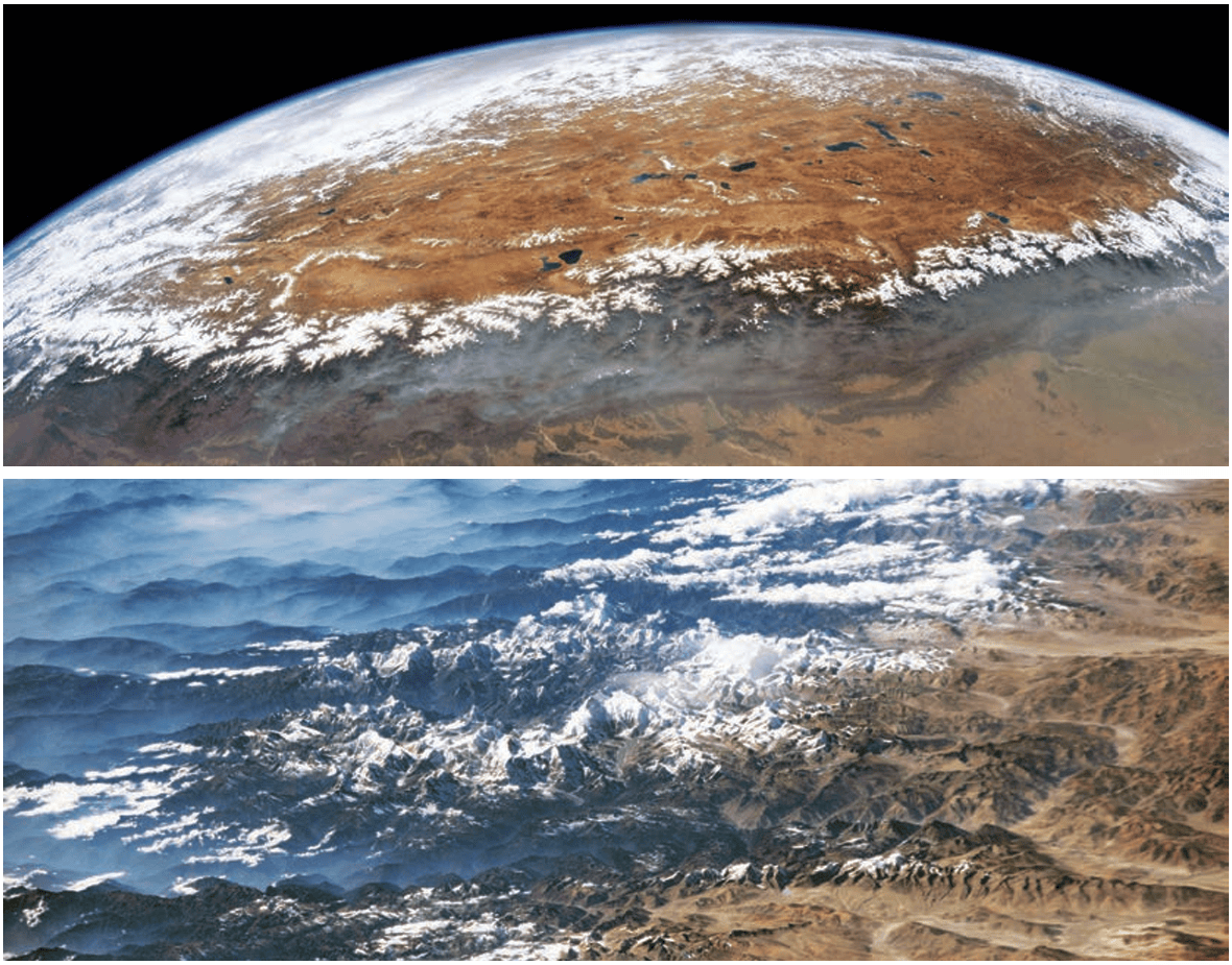
The Himalayas seem to touch the sky. In fact, many of its peaks
are over 8000 metres in height and are together called the
‘Eight Thousanders’. This mountain range stretches across six
countries in Asia: India, Nepal, Bhutan, China, Pakistan, and
Afghanistan. Can you name the highest mountain in the world?
In the summer, the snow on the mountains melts and feeds major rivers, such as the Ganga, Indus, and Brahmaputra. These rivers and their tributaries provide water for drinking, farming, and industrial use, connecting with the lives of hundreds of millions of people. Hence, the Himalayas are sometimes called the ‘Water Tower of Asia’. The Himalayas are also important to many cultures and belief systems. The mountains themselves are considered sacred, and temples and monasteries have been built within them, attracting monks and spiritual seekers from around the world who come to pray and meditate.
DON’T MISS OUT
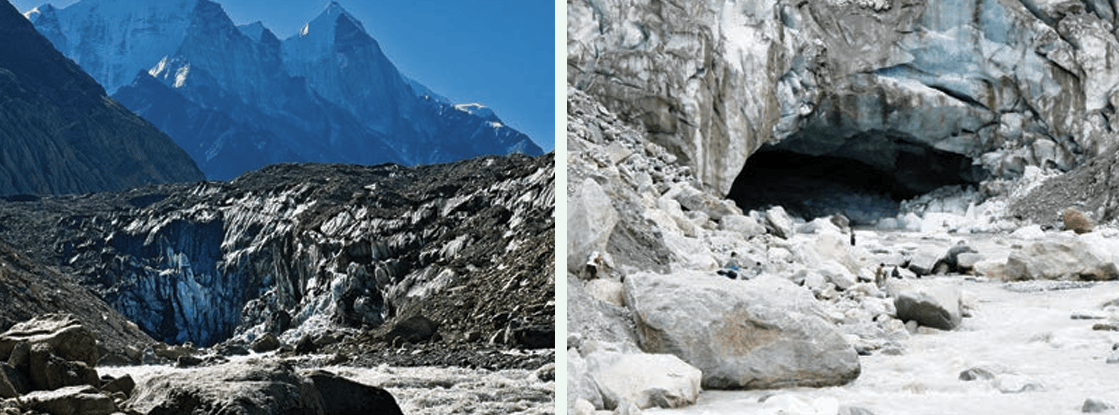
The Bhagirathi River, a major tributary of the Ganga, originates
from Gaumukh (‘Cow’s Mouth’), in Uttarakhand.
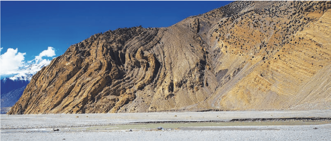
How the Himalayas were formed ... an interesting story
A long, long time ago, India was part of a much bigger landmass called ‘Gondwana’, where its neighbour was Africa! At some point, it broke away and slowly started moving north. About 50 million years ago, it reached the landmass of Eurasia and collided with it. As India pushed against Eurasia, the land between them crumpled and rose up — just like how a carpet wrinkles when you push it. That’s how the mighty Himalayan mountains were formed! Amazingly, India is still pushing into Asia today, very slowly — about five centimetres each year, which is much slower than the rate at which your hair grows. This means the Himalayas are still growing taller, just a tiny bit each year — about five millimetres, but over a millennium, that adds up to five metres!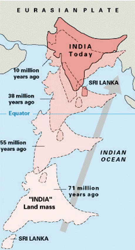
DON'T MISS OUT
The word ‘Himalaya’ is a combination of two Sanskrit
words — hima, meaning ‘snow’, and ālaya, meaning ‘abode’ or
‘dwelling’ — thus, ‘abode of snow’.
- The Himadri (the Greater Himalayas) are the highest and most rugged part of the range, home to towering peaks like Mount Everest and Kanchenjunga. This region remains snow-covered throughout the year. Life here is tough, and there are not many human settlements.
- The Himachal (the Lower Himalayas) lie south of the
Greater Himalayas and have a more moderate climate,
allowing rich biodiversity and human habitation. Popular
hill stations, such as Nainital (Uttarakhand), Darjeeling
(West Bengal), Shimla (Himachal Pradesh), and Mussoorie
(Uttarakhand), are located in this region.
- The Shivalik Hills (the Outer Himalayas) form the
outermost and lowest range, consisting of rolling hills and
dense forests. These foothills are rich in wildlife, serving as
a transition zone between the Himalayas and the Gangetic
Plains (also called the Northern Plains).
LET’S EXPLORE
Can you locate the names of the states in the different parts
of the Himalayas? Take the help of both the physical and
political maps for this exercise.
DON'T MISS OUT
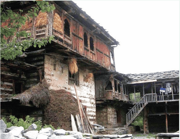
The
traditional
house
construction method in the
western Himalayan region is
known as ‘kath-kuni’ or ‘dhajji
dewari’ style of houses. A
combination of locally available
stone and wood is used, which
not only keeps the house warm
but also resists damage in the
event of mild earthquakes.
DON'T MISS OUT
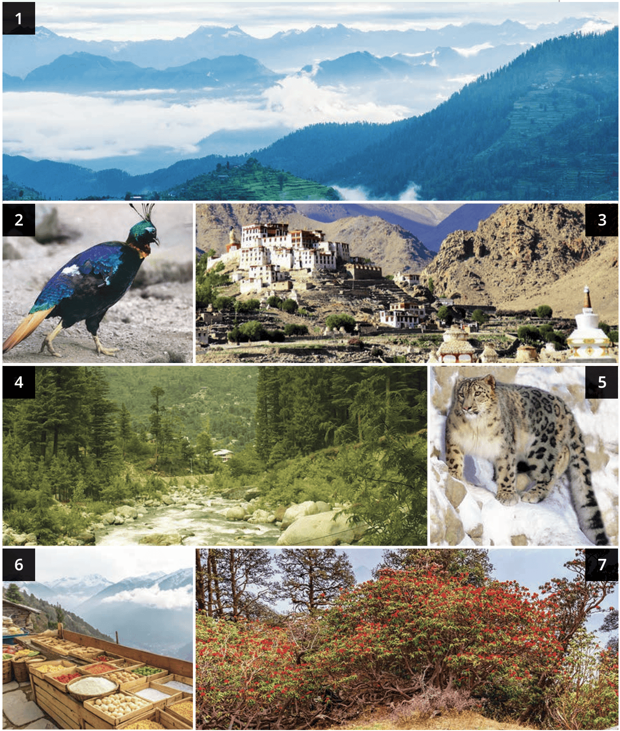
The Great Himalayan National Park in Himachal Pradesh has a
wide diversity of flora and fauna. The park has been declared a World Heritage Site by UNESCO. The biodiversity of the park
is being preserved by the government as well as the village
communities that live inside the park.
The cold desert of India
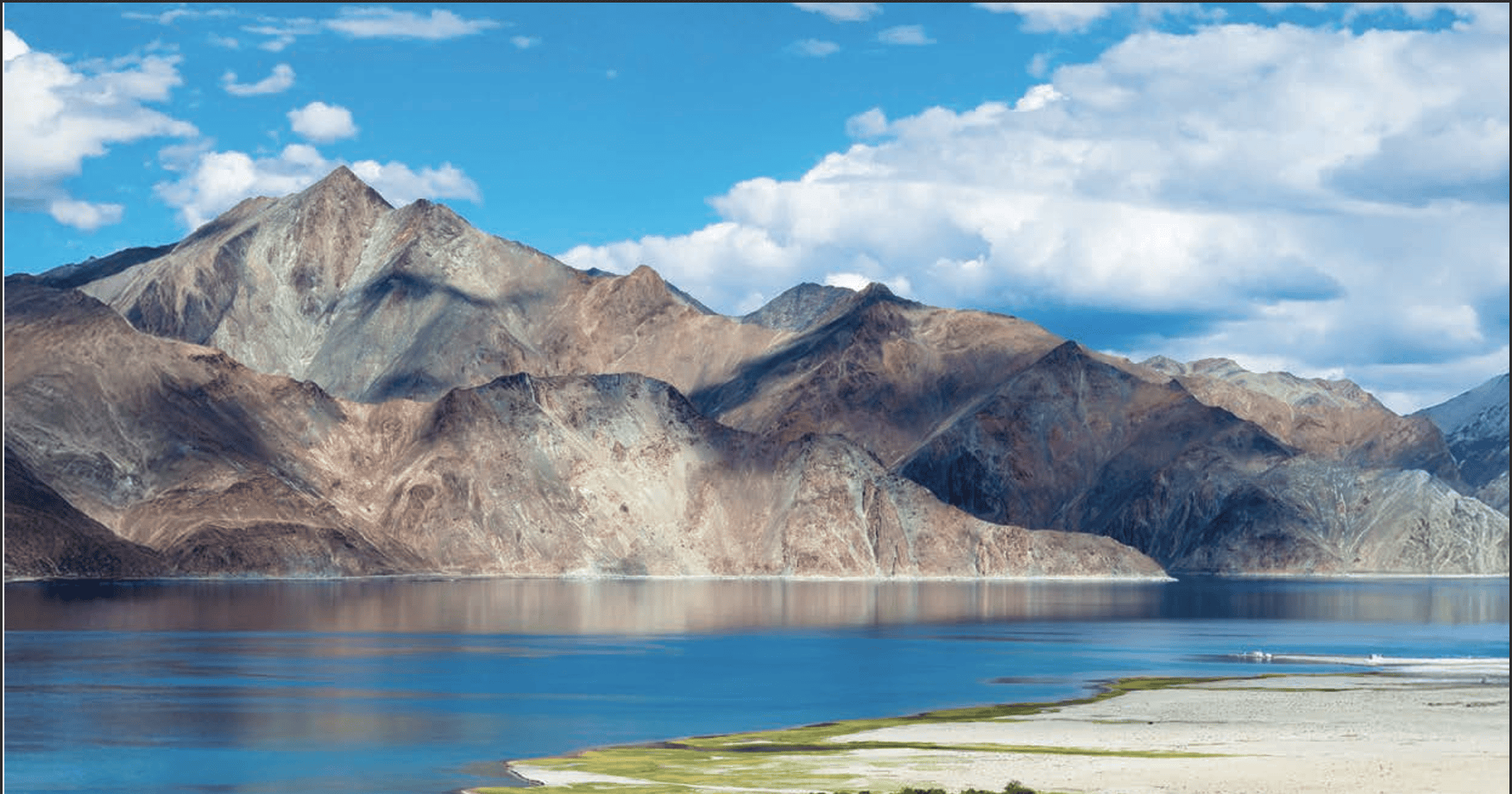
The word ‘desert’ immediately evokes an image of a hot place. However, there are also cold deserts, and we have one in India. Ladakh is a cold desert where winter temperatures drop below –30°C. There is very little rainfall, and the landscape is rugged, with rocky terrain, deep valleys, and lakes such as Pangong Tso (tso means lake).
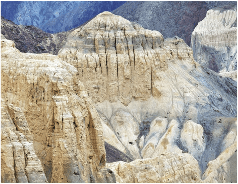
The terrain here resembles that of the moon; hence, it is called ‘moonland’. Geologists explain the formation of this terrain, as we saw earlier, by the fact that the mountains were ‘folded’ when the Indian landmass collided with Eurasia. This folded portion was part of an ocean, and so the rocks in this area are made largely of sand and clay. Wind and rain have eroded the mountains into the shapes you see in the photograph.
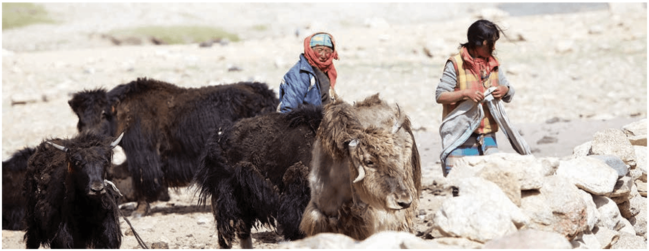
Despite the harsh conditions, Ladakh is home to unique
wildlife like snow leopards, ibex, and Tibetan antelopes. The
Ladakhi people lead a simple life. The region is known for its
ancient monasteries and colourful festivals such as Losar and
the Hemis Festival.
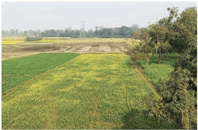
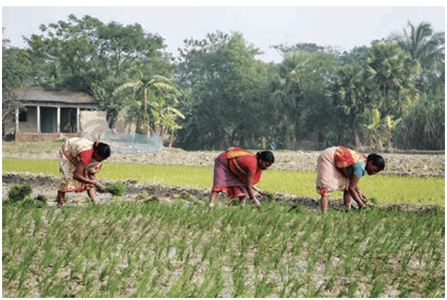
The Gangetic Plains
As we move southwards from the Himalayas, we reach the
vast and fertile Gangetic Plains. These plains have been an
important part of the history and civilisation of India. These
plains are nourished by mighty rivers originating from the
Himalayas, providing a vital lifeline: water. The Ganga, Indus,
and Brahmaputra river systems, along with their extensive
network of tributaries, enrich the soil with minerals, making the
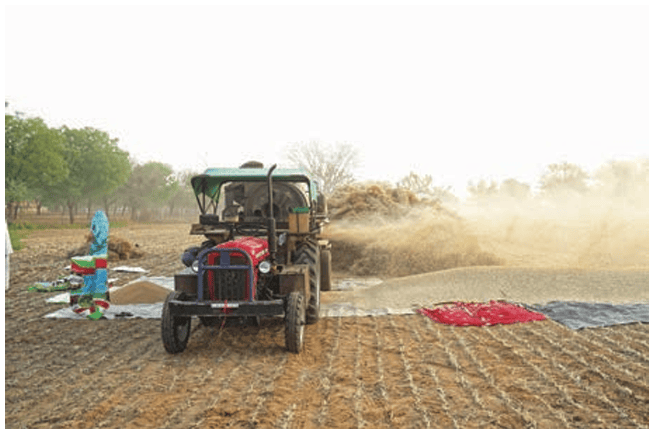
region highly fertile and ideal for agriculture. The rivers bring
with them minerals that enrich the soil, enabling abundant
agriculture. The rivers are also a source for generating electricity.
A large proportion of India’s population lives in these plains.
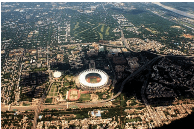
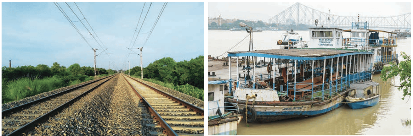
The flat land of the Northern Plains has allowed for the development of an elaborate transportation network. Road and railway networks facilitate the movement of people and goods over long distances. As you will see in the Tapestry of the Past chapters, the Ganga, the Brahmaputra and other rivers have been used for millennia for travel and trade.
DON'T MISS OUT
Most rivers are named after goddesses — Ganga, Yamuna,
Kaveri, etc. The name of Brahmaputra, however, means ‘the
son of Brahma’. This river gets bigger during summer instead
of drying up! Can you guess why?
LET’S EXPLORE
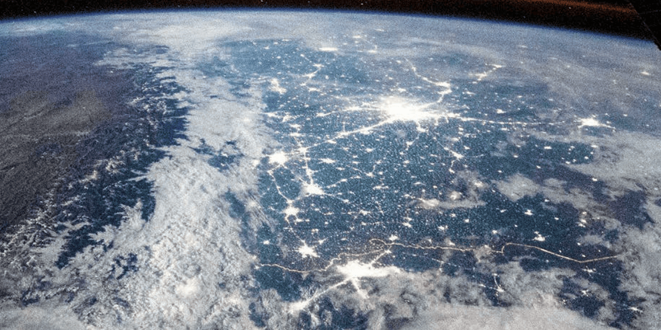
Notice the concentration of lighting in the plains. What could
be the reason for this concentration?
The Great Indian Desert or Thar Desert
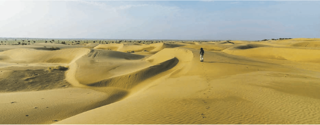
If we move westward on the map, you will notice a yellowish area. This area is the Thar Desert. What do you see? A vast stretch of golden dunes, rugged terrain, and a wide-open sky?
LET’S EXPLORE
What is the shape of a sand dune? While mountains are
made of rock and their shape is fixed, why do you think sand
dunes also have a similar shape, even though they are made
of sand?
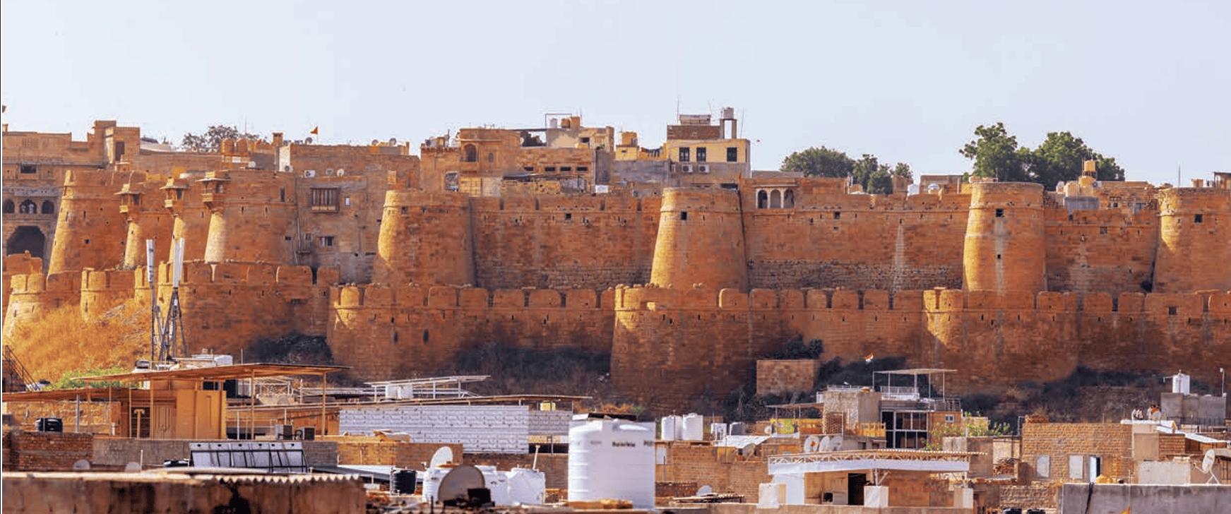
Sand dunes are formed when the wind shifts and shapes the sand into hill-like formations. Sometimes these rise as high as 150 metres.
The Thar is a vast arid region. Most of it lies within India, spanning the states of Rajasthan, Gujarat, Punjab, and Haryana. The desert acts as a natural barrier due to the harsh conditions that deter human and animal movement — including very high daytime temperatures and cold nights, as well as a lack of access to water.
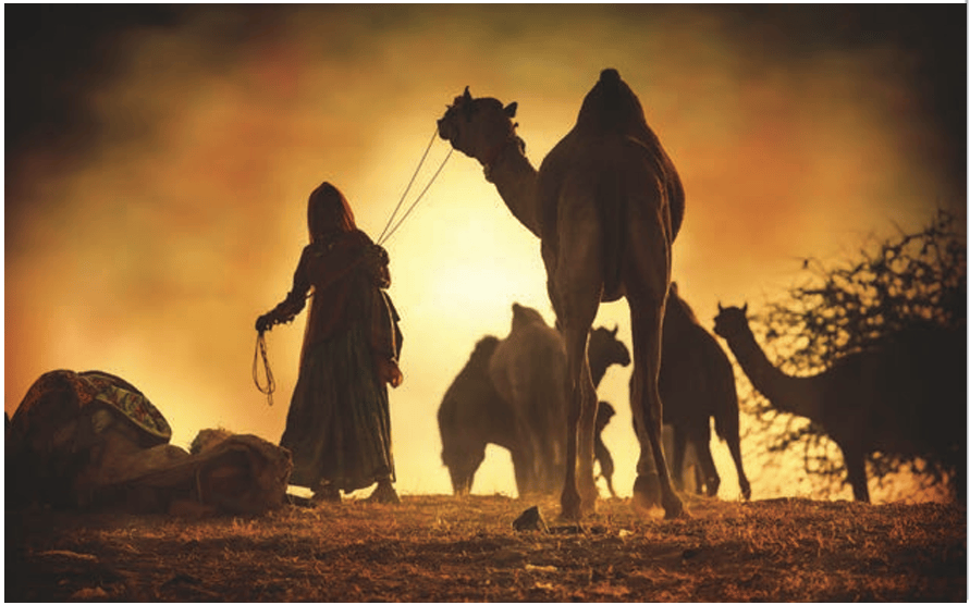
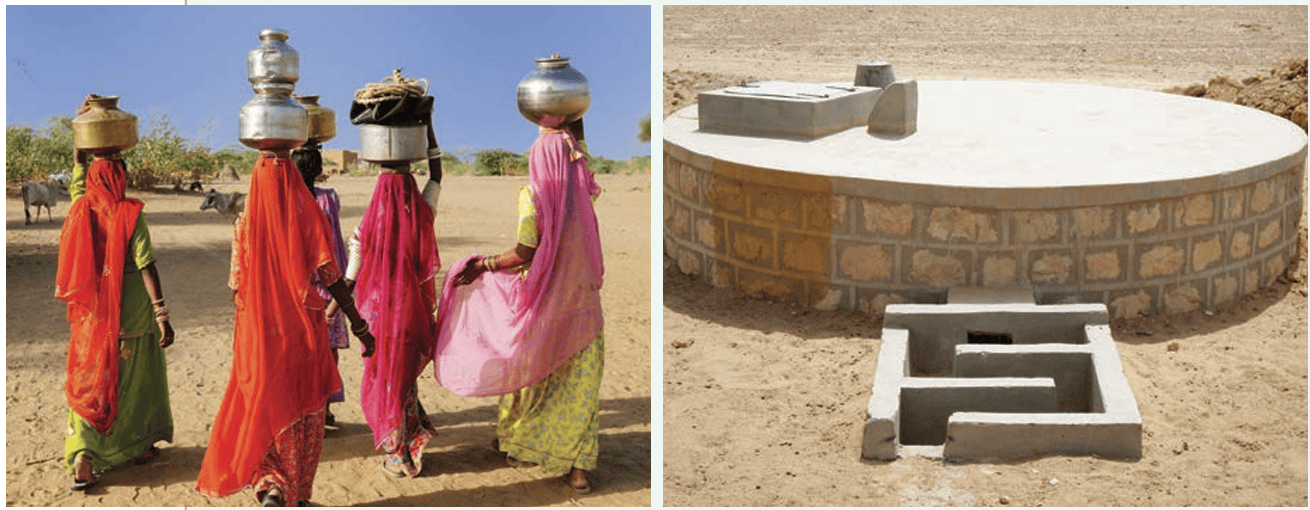
People living in the Thar have adapted their way of life to the
place and what it offers; food habits, clothing and lifestyle are
suited to these harsh conditions.
DON'T MISS OUT
The Aravalli Hills
LET’S EXPLORE
Let’s go back to the map. Trace your path slowly from the
Thar Desert towards the east. Do you see the Aravalli Hills?
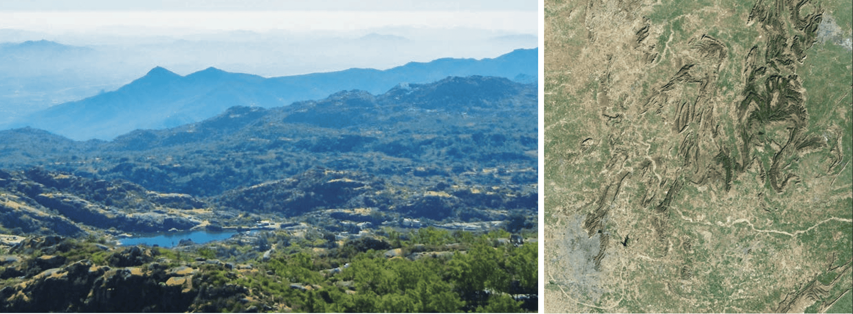
The Aravallis are among the oldest mountains in the world, some 2.5 billion years old! The range has many peaks and ridges. Although its highest peak, Mount Abu, towers at over 1700 m, most of its hills are between 300 and 900 metres high. Isn’t it fascinating that a drive of about 4 and a half hours can take us from Mount Abu in the Aravallis to Jodhpur in the Thar Desert, a drive into a completely different geography?
LET’S EXPLORE
Look at the political map in the textbook and identify the states
that the range spans. Did you see Delhi, Rajasthan, Haryana
and Gujarat?
The Aravallis play a vital role in shaping the geography and climate of northwestern India. One of its most important functions is acting as a natural barrier, preventing the Thar Desert from expanding further eastward. You will read more about this later.
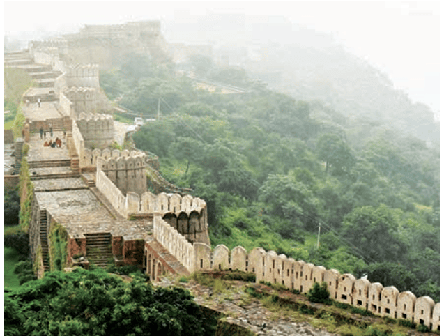
The Aravallis, rich in minerals like marble, granite, zinc, and copper, have supported mining and construction activities for centuries. In fact, evidence from its ancient mines at Zawar has shown that over eight centuries ago, Indians were the first in the world to master the delicate process of extraction of zinc. Historic forts, such as Chittorgarh, Kumbhalgarh, and Ranthambore, are located here.
The Peninsular Plateau
LET’S REMEMBER
A plateau is a landform that rises up from the surrounding
land and has a more or less flat surface; some of its sides are
often steep slopes.
It is also a very old land formation! Since this region is a peninsula, surrounded by water on all three sides by the Arabian Sea, the Bay of Bengal, and the Indian Ocean, it is called a peninsular plateau.
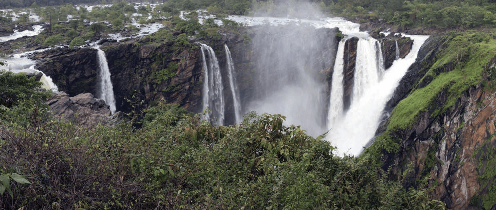
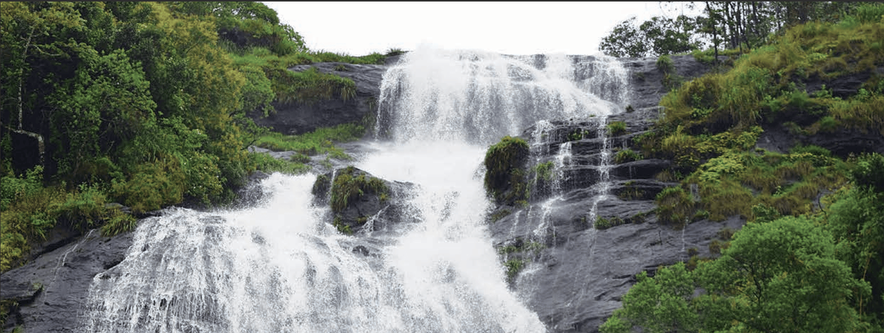
The plateau is bordered by two mountain ranges, the Western Ghats and Eastern Ghats. The Western Ghats are taller and run along the western coast like a wall, with many beautiful waterfalls f lowing down their steep sides during the monsoon season.
DON'T MISS OUT
The Western Ghats have been declared a UNESCO World
Heritage Site. They are home to many rivers and have a rich
biodiversity. The northern portion of the Western Ghats are
also known as the Sahyadri Hills.
Rivers like the Godavari, Krishna, and Kaveri flow across the plateau from west to east. These rivers are important for farming and provide water to millions of people.
LET’S EXPLORE
Look at the physical map of India given at the end of the
book. Notice the direction of the flow of the rivers.
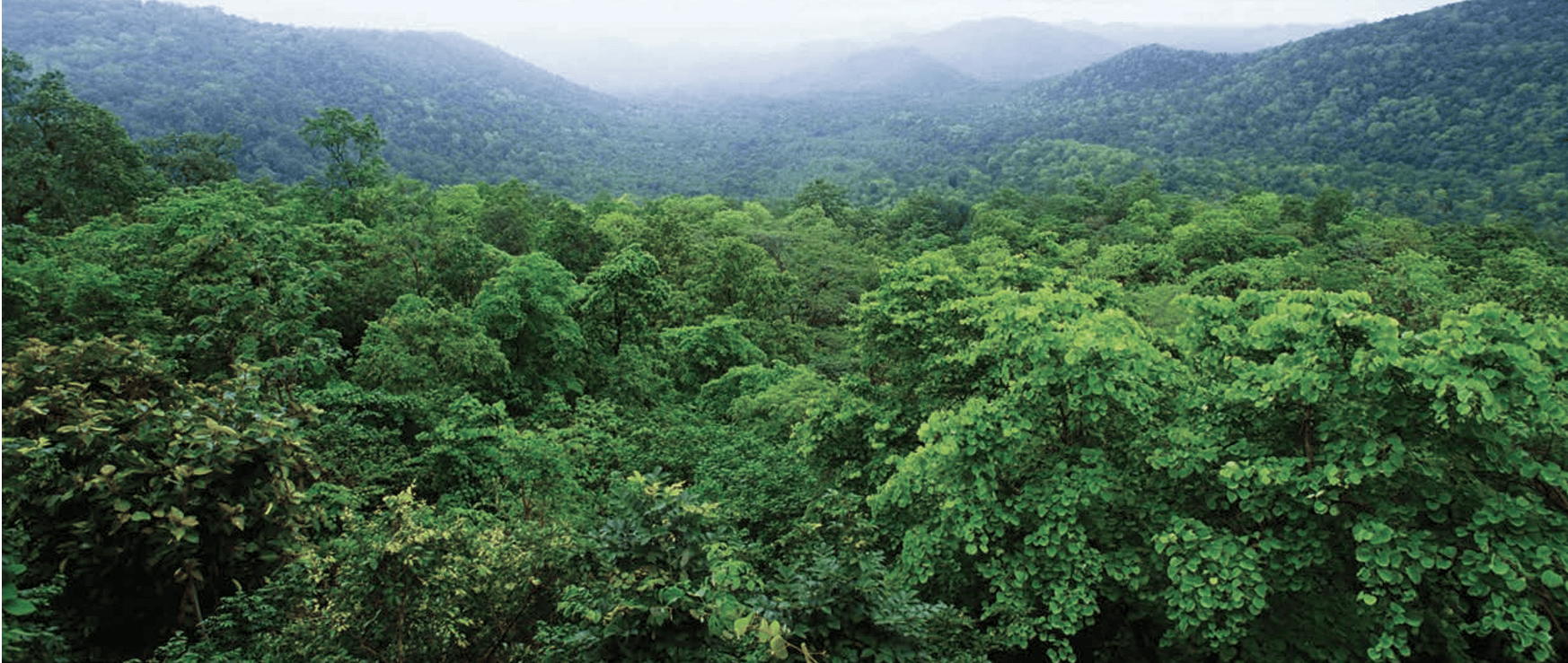
Dense forests on the plateau are home to tribal communities, including the Santhal, Gond, Baiga, Bhil, and Korku. These tribes have distinct languages, traditions, and ways of life closely connected to Nature.
LET’S EXPLORE
Tribal communities are largely spread over the states of
Jharkhand, West Bengal, Odisha, Assam, Madhya Pradesh,
Chhattisgarh, Maharashtra, Telangana, and Gujarat. Examine
the physical and political maps at the end of this book to locate
the states and connect them to their location on the physical
map.

India’s Amazing Coastlines
India’s coastline is dotted with beautiful beaches, rocky cliffs, and lush green forests. Some beaches have golden sand while others have black rocks. Some islands have coral reefs while others are covered in thick jungles. India’s coasts are full of surprises! The Indian coastline is over 7500 km long.LET’S EXPLORE
- Look at the physical map of India in your school atlas or wall map and find the names of five rivers that flow into the Bay of Bengal. Find out India’s coastal states and discuss the difference between the western and eastern coastal plains.
- Do you know what it is called when these rivers split into multiple streams near the coast? Discuss with your teacher in class to find out!
The West Coast of India
The West Coast of India stretches from Gujarat to Kerala, passing through Maharashtra, Goa, and Karnataka. Most rivers here originate in the Western Ghats, flow swiftly, and form estuaries. The coastline is shaped by alluvial deposits from short rivers and features coves, creeks, and estuaries, with the Narmada and Tapti estuaries being the largest.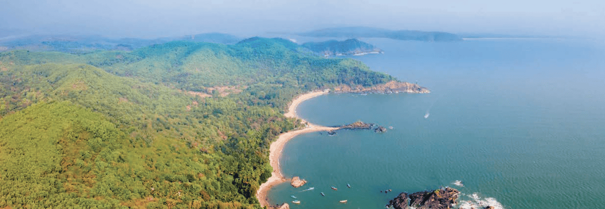
The west coast has many important ports and cities. These have been the centres of economic activity for millennia.
The East Coast
The East Coast lies between the Eastern Ghats and the Bay of Bengal, stretching from the Ganga delta to Kanyakumari. It has wide plains and major river deltas, including Mahanadi, Godavari, Krishna, and Kaveri. Important water bodies like Chilika Lake and Pulicat Lake (a lagoon, which is a body of water separated from larger bodies of water by a natural barrier) are found here.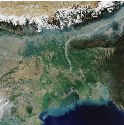
Deltas are landforms formed at the mouth of a river when it deposits sediments into a larger body of water, such as an ocean, a lake, or another river. Over time, these sediments build up, forming a triangular or fan-shaped area. The Godavari, Krishna, Kaveri and Mahanadi rivers create fertile deltas, making the land ideal for farming.
Indian Islands
The Indian Islands refer to the group of islands scattered across the Indian Ocean, the Arabian Sea, and the Bay of Bengal, which form part of India’s territory. India has two major island groups — Lakshadweep in the Arabian Sea and the Andaman and Nicobar Islands in the Bay of Bengal. These islands have unique wildlife, beautiful beaches, coral reefs, and volcanoes. Several ancient tribes made these islands their home tens of thousands of years ago.Lakshadweep islands
Lakshadweep is an archipelago (a group of islands) located in the Arabian Sea, close to the Malabar coast of Kerala. It is made up of 36 islands made of coral. Not all islands are inhabited by people. India controls a vast marine area, allowing for fishing, resource exploration, and environmental protection.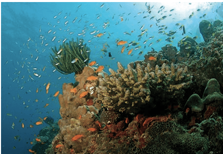
Andaman and Nicobar islands
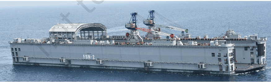
This archipelago comprises more than 500 large and small volcanic islands, divided into two distinct groups — the Andaman and the Nicobar Islands. Their location is very important. They are like the outposts of India, keeping an eye on the ocean. It is home to a variety of flora and fauna. The Andaman Islands are also significant from a historical point of view — many of our freedom fighters were jailed there under the most severe conditions in a prison complex called ‘Cellular Jail’. It has been preserved to remind us of the tremendous sacrifices that our forefathers made so we could be free. We will discuss this some more in higher classes.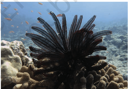
DON'T MISS OUT
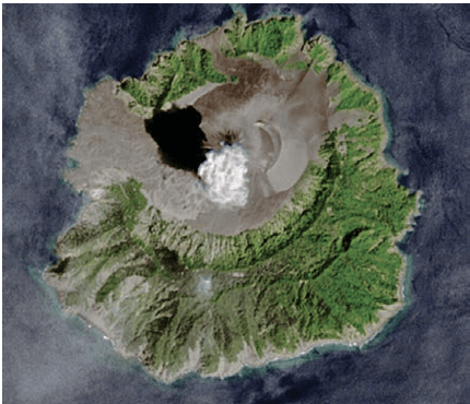
Barren Island (Fig. 1.39 above) in the Andaman and Nicobar
Islands is the only active volcano in India. It sometimes erupts,
sending smoke and lava into the sky!
The Delta in West Bengal and the Sundarbans
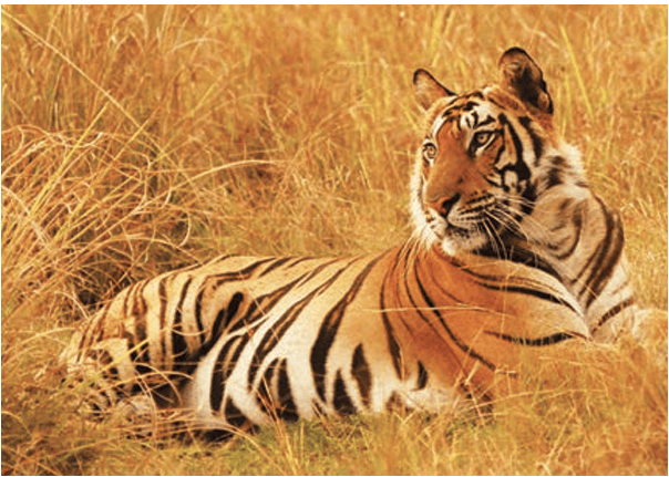
As we travel back from the islands towards the eastern side of the Himalayas via the Bay of Bengal, we come to the Sundarbans. This is located in the delta of the Ganga, Brahmaputra (you saw them earlier in the chapter) and their tributaries. This delta has a unique combination of the river, sea and land. About half of it is located in India, and the rest is in Bangladesh. This is also a UNESCO Heritage site. The Sundarbans are home to many species, including the Royal Bengal Tiger.Note: Do remember to look at the map and identify where the delta is.
The hills of the Northeast
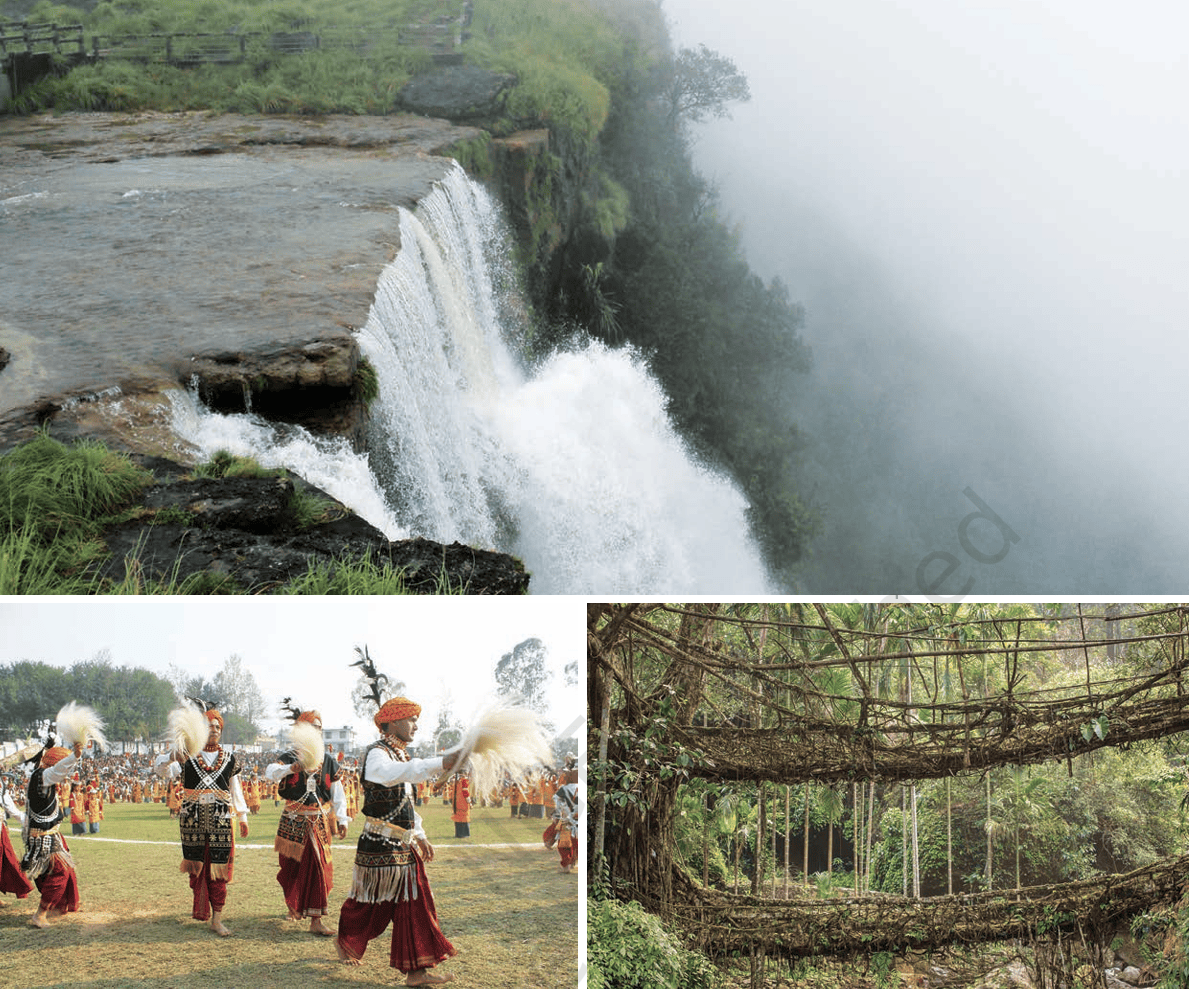
Stay on the map as we move towards the hills of the Northeast, our final destination for now. Can you see Garo, Khasi, and Jantia marked on the map? These hills, part of the Meghalaya Plateau, are known for their lush greenery, heavy rainfall, and breathtaking waterfalls. This region experiences one of the highest rainfalls in the world, making it rich in forests, unique wildlife, and fertile land.
DON'T MISS OUT
Mawlynnong Village, situated in
the East Khasi Hills of Meghalaya,
is renowned as the ‘cleanest village
in Asia’. This picturesque village
is famous for its well-maintained
cleanliness, bamboo dustbins, and
eco-friendly living practices. The
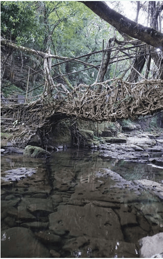
village is also known for its living
root bridges, which are created by
weaving tree roots over the course
of many years.
Before we move on …
- India gives its name to the subcontinent it is a part of.
- It has many diverse geographical features, ranging from the snowy Himalayas to the heat of the Thar Desert. The plains are watered by a large number of rivers. There is also a peninsular plateau with the Arabian Sea on the west and the Bay of Bengal in the east.
- These diverse geographic features have created a variety of conditions with respect to soil, flora, fauna, life and economic opportunities, and honed a rich culture.
- These geographical features have played an important role in shaping our civilisation.
Questions and activities
1. What, in your opinion, are two important geographical features of India? Why do you think they are important?
2. What do you think India might have looked like if the
Himalayas did not exist? Write a short note or sketch a
drawing to express your imagination.
3. India has been called a ‘mini-continent’. Based on what you’ve read, why do you think this is so?
4. Follow one of India’s big rivers from where it starts to
where it meets the ocean. What are the different ways in
which people might utilise this river along its journey?
Discuss in groups in your class.
5. Why is the southern part of India referred to as a peninsular
plateau?
6. Which UNESCO Heritage Site mentioned in this chapter
did you find more interesting? Write a short paragraph to
describe what about it is interesting.
7. Look at the two maps of India, physical as well as political,
given at the end of this book. Identify the place you are
at now. Which physical feature of India would you use to
describe its location?
8. Food preservation techniques differ from place to place across India. They are adapted to local conditions. Do a class project. Gather different methods of preserving food. Hint: Drying vegetables when they are in season for use during the off-season.
9. Despite having such different regions (mountains, deserts,
plains, coasts), India remains one country. How do you think
our geography has helped unite people?